


KELLOGG TWP Voting District, Jasper County, Iowa
About
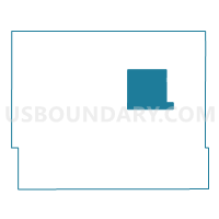
Outline

Summary
| Unique Area Identifier | 582430 |
| Name | KELLOGG TWP Voting District |
| County | Jasper County |
| State | Iowa |
| Area (square miles) | 37.62 |
| Land Area (square miles) | 37.58 |
| Water Area (square miles) | 0.04 |
| % of Land Area | 99.90 |
| % of Water Area | 0.10 |
| Latitude of the Internal Point | 41.73051470 |
| Longtitude of the Internal Point | -92.93679530 |
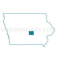
Maps

Graphs
Select a template below for downloading or customizing gragh for KELLOGG TWP Voting District, Jasper County, Iowa


Neighbors
Neighoring Voting District (by Name) Neighboring Voting District on the Map
- BUENA VISTA TWP W/O NEWTON Voting District, Jasper County, IA
- HICKORY GROVE TWP Voting District, Jasper County, IA
- MALAKA TWP Voting District, Jasper County, IA
- MARIPOSA TWP Voting District, Jasper County, IA
- NEWTON TWP PART W/O LAMBS GROVE & NEWTON Voting District, Jasper County, IA
- NEWTON W/NEWTON TWP & PALO ALTO TWP PARTS Voting District, Jasper County, IA
- RICHLAND TWP Voting District, Jasper County, IA
- ROCK CREEK TWP Voting District, Jasper County, IA
Top 10 Neighboring County Subdivision (by Population) Neighboring County Subdivision on the Map
- Newton township, Jasper County, IA (15,576)
- Palo Alto township, Jasper County, IA (3,598)
- Kellogg township, Jasper County, IA (1,114)
- Rock Creek township, Jasper County, IA (961)
- Buena Vista township, Jasper County, IA (635)
- Richland township, Jasper County, IA (360)
- Malaka township, Jasper County, IA (313)
- Hickory Grove township, Jasper County, IA (292)
- Mariposa township, Jasper County, IA (252)
Top 10 Neighboring Place (by Population) Neighboring Place on the Map
Top 10 Neighboring Unified School District (by Population) Neighboring Unified School District on the Map
- Newton Community School District, IA (21,271)
- Grinnell-Newburg Community School District, IA (12,151)